Geospatial mineral exploration intelligence
One workspace that brings together GIS analysis, historical reports, and data export, connected to live services across Western Australia, Queensland, South Australia, the Northern Territory, New South Wales, New Zealand, and Norway.
How it works
Three steps from map to brief
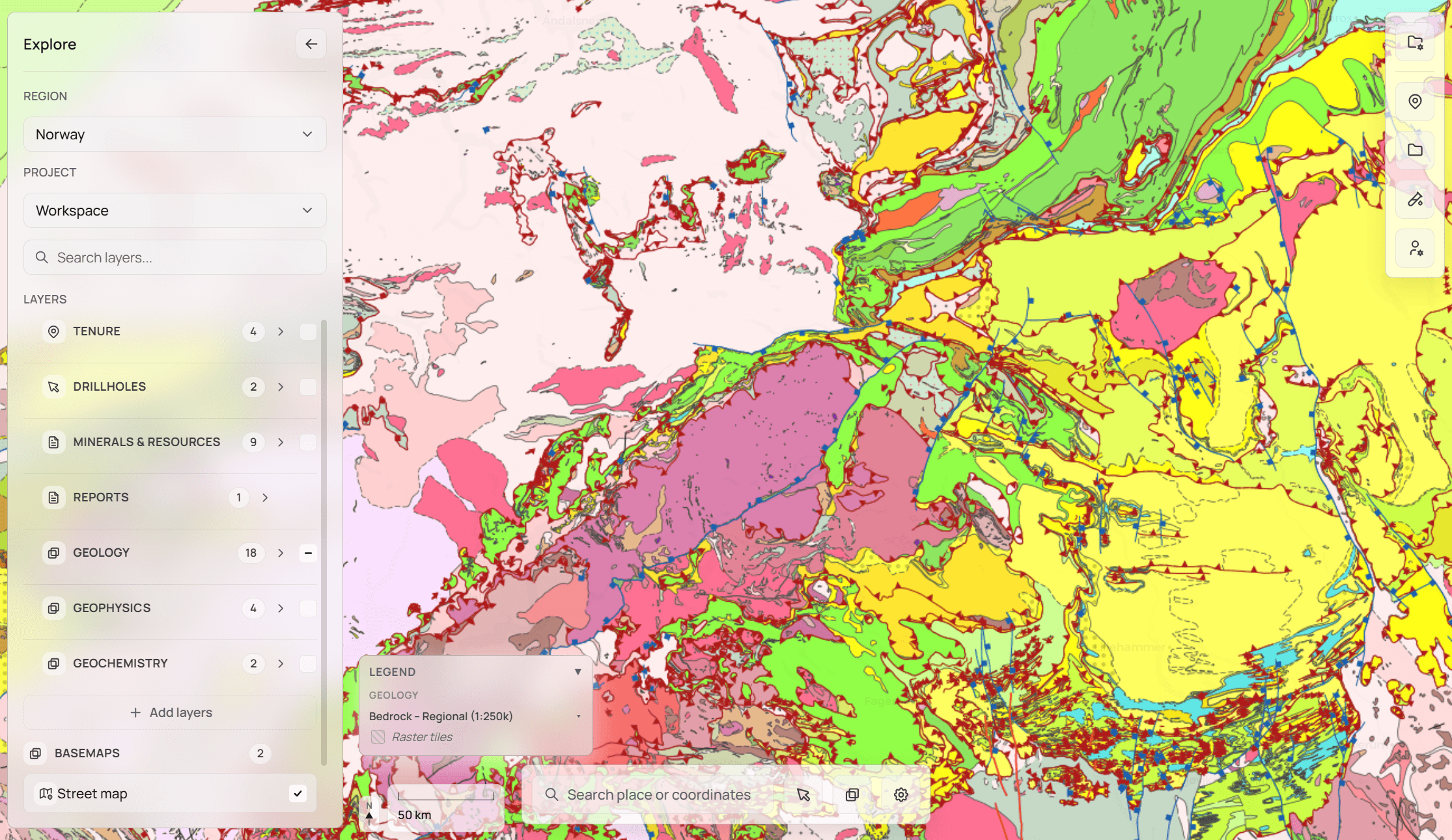
Open Explore and choose a region
The map connects to live geological survey services. Geology, tenements, and reports are ready to layer on immediately.
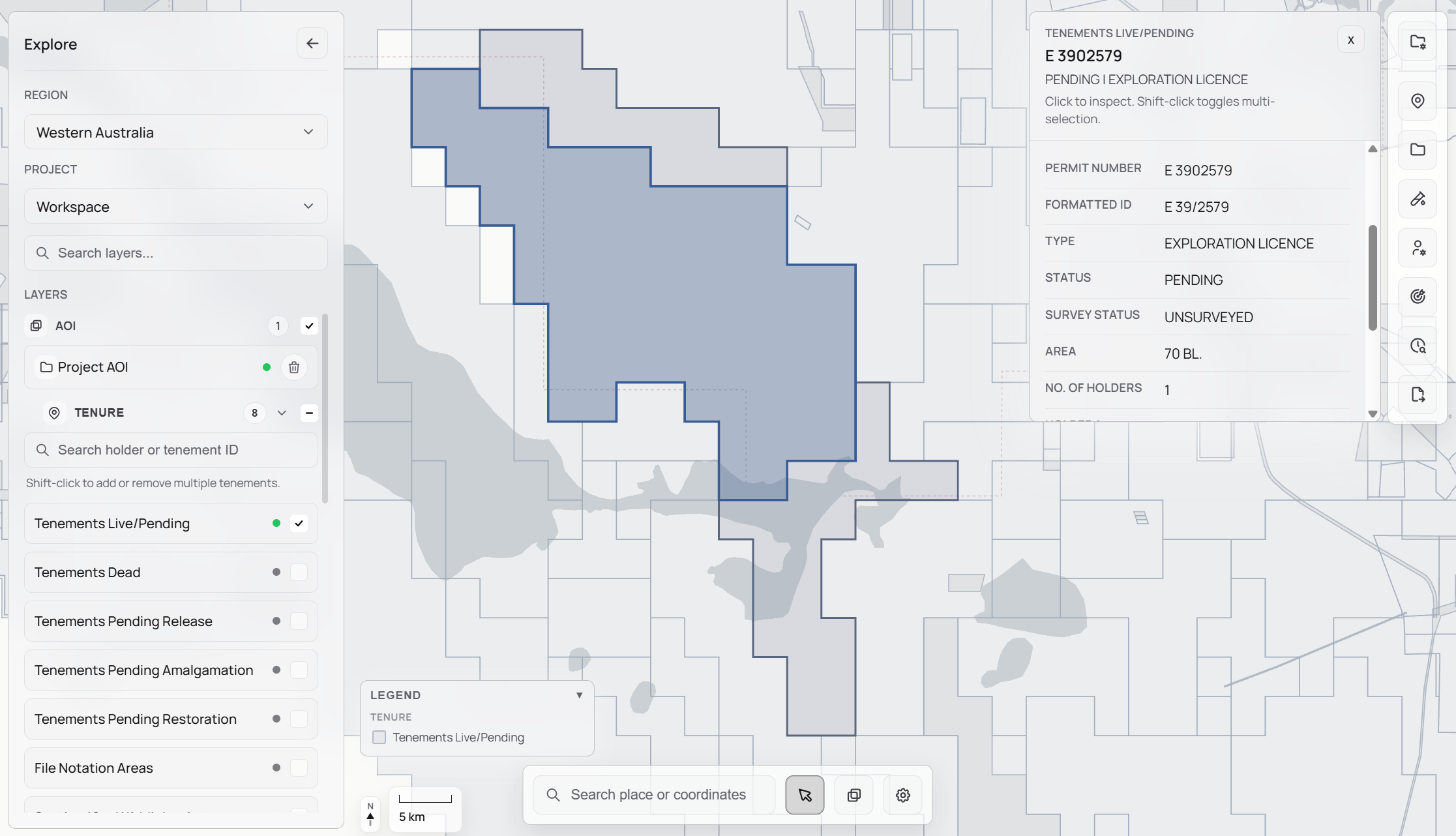
Draw your ground
Polygon draw, shapefile upload, or tenement selection. Your AOI scopes everything including data loading, analysis, and synthesis.
Work from evidence
Surface any area's tenure history, assay data, and overlapping reports. Export it all in one click, every output from the same map view.
Explore the tools
Nine tools built around the real workflow of a global exploration geologist, from first look at a piece of ground to a drill-ready decision.
AOI Analysis
A complete picture of any piece of ground.
Drop a boundary and Stratum assembles the full record: current licence status, tenure timeline, who has worked the ground, and what data exists across all connected services.
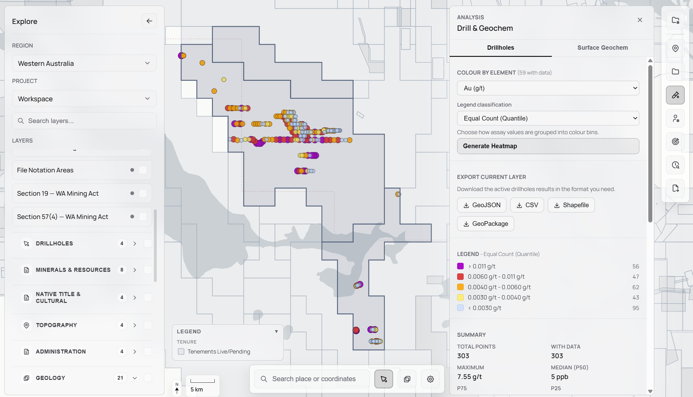
Drillholes & Geochemistry
Collars, assays, and export in one step.
Open-file drillhole collars and surface geochem samples render on the map with ppm values visible. Export the full dataset as CSV, Shapefile, GeoJSON, or GeoPackage in one click.
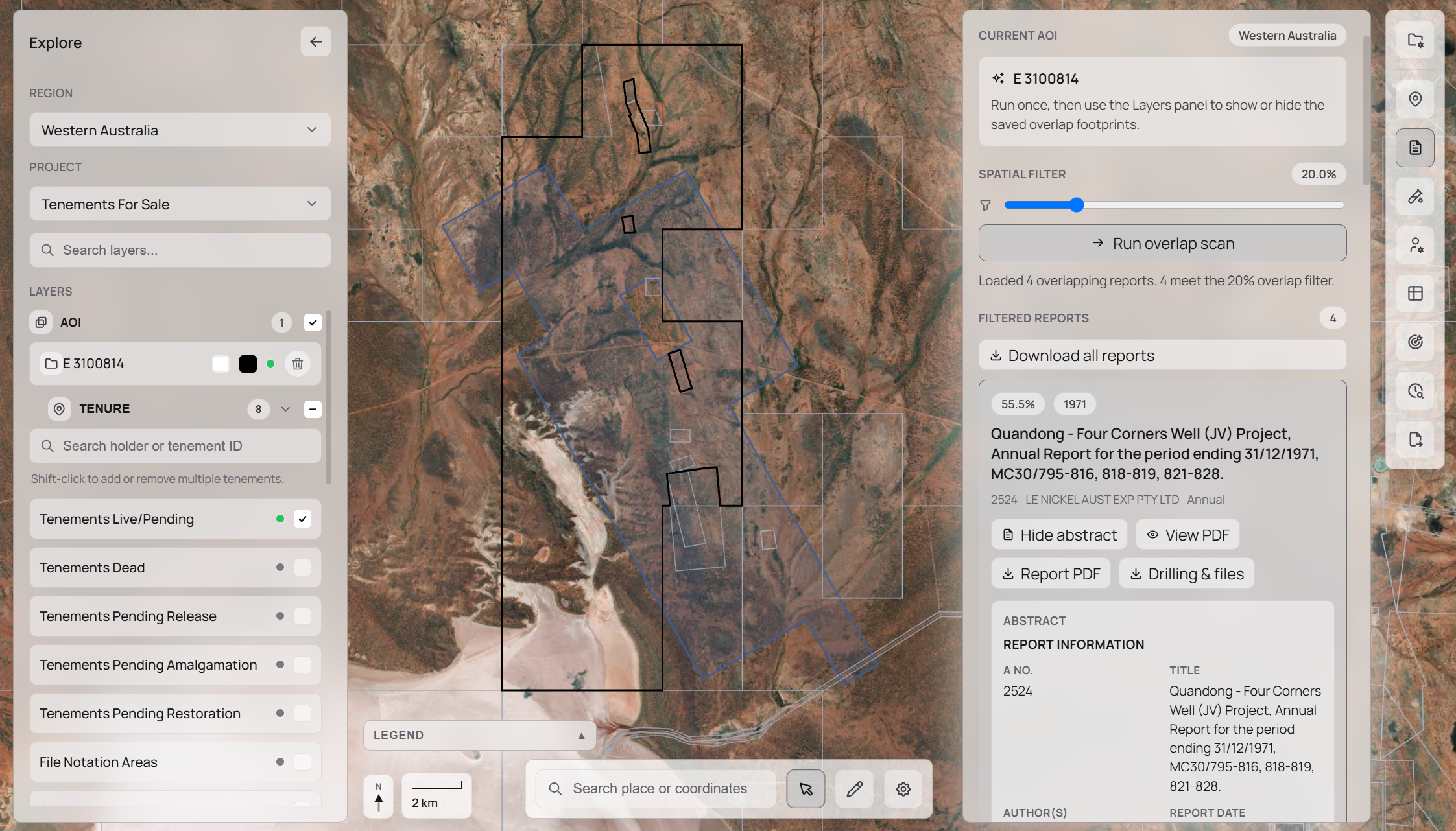
Report Intelligence
Every relevant report, ranked and read.
Stratum connects to WAMEX, NZPAM, and regional portals, ranks every report by spatial overlap with your AOI, and delivers an AI-synthesised brief with cited findings, without opening a single PDF.
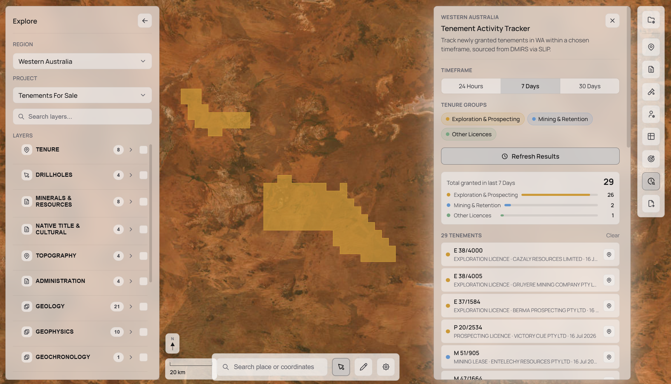
Tenement Activity
Know the moment tenure moves.
Track live changes across granted, pending, and expiring tenements in your region. New applications, lapses, and transfers surface automatically, with no portal-checking required.
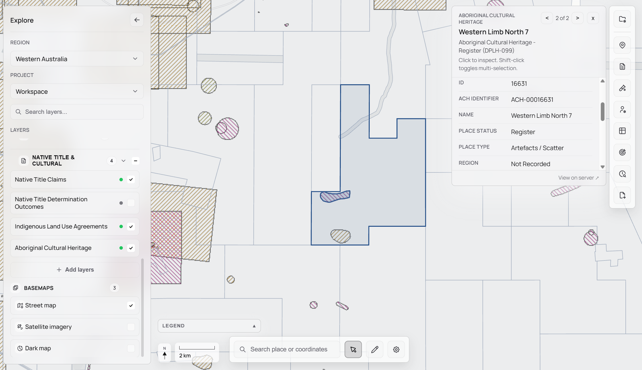
Native Title & Cultural Heritage
Obligations on the map before you plan.
Overlay registered Native Title determinations, RATSIB areas, and cultural heritage records on your project map. Understand statutory obligations before committing to a drill program.
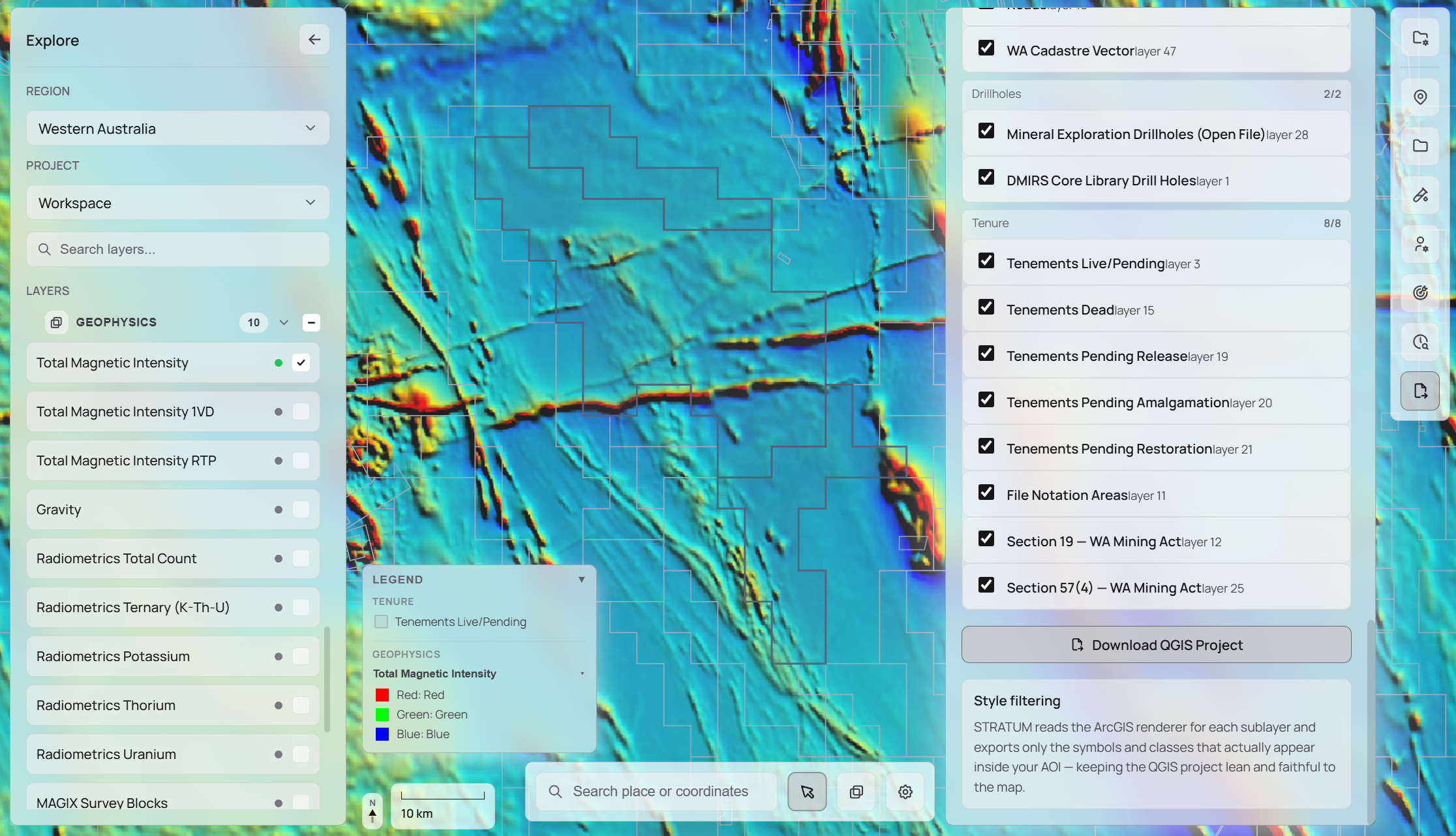
Geophysics Overlay
Magnetics, gravity, and radiometrics, side by side.
Toggle between geophysics datasets from connected government survey services. Stack layers against geology and tenure and adjust opacity to build your structural interpretation without leaving the map.
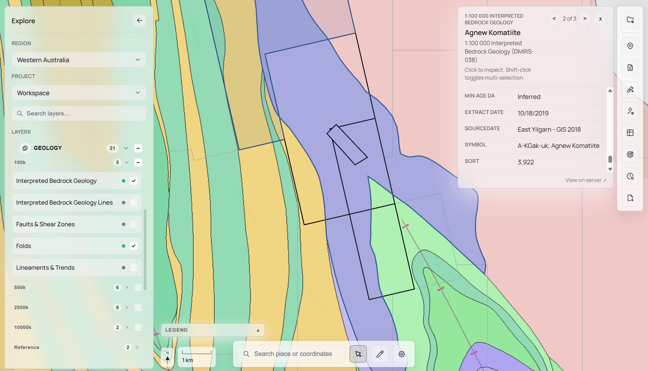
Geology Layers
Live bedrock geology at every scale.
Bedrock geology from GSWA, GSQ, SARIG, GNS Science, and NGU renders at multiple scales in the viewer. Switch regions and the geology layer updates to match what is actually available there.
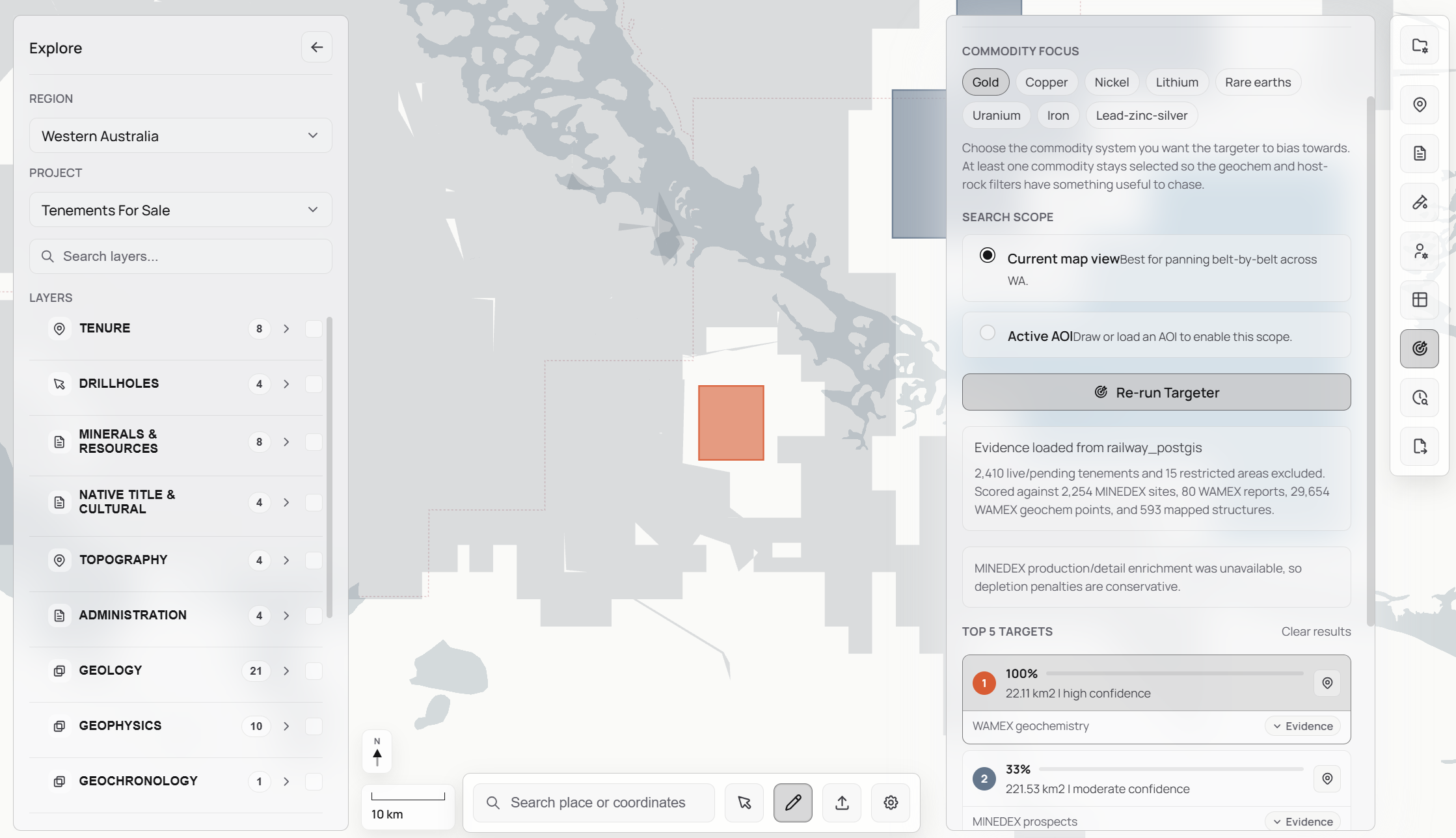
Exploration Targeter
Rank your targets before you drill.
Combines tenure history, drillhole signals, geochemistry, and report evidence to surface the highest-priority targets within your AOI. Ranked, cited, and ready to present.
GIS Exporter
Take your entire project with you.
Export all active layers, data, and annotations as a single packaged file. Choose from GeoPackage, Shapefile bundle, or GeoJSON for handoff, archiving, or loading into a third-party GIS.
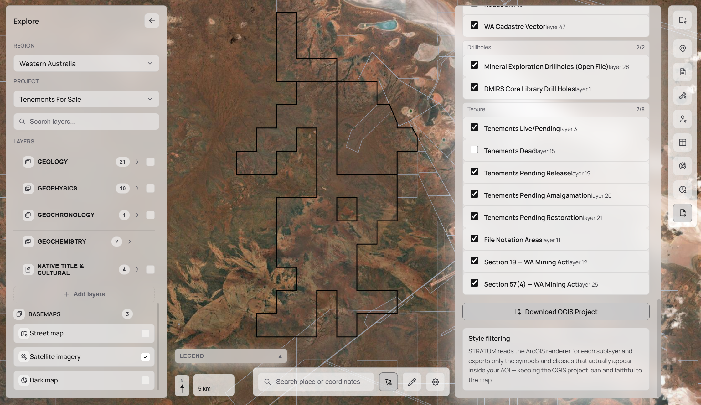
Data per region
Live connections to government survey services used by exploration teams worldwide, with more regions being added continuously.
Western Australia
GeoVIEW.WA / GSWA (DMIRS)
- Exploration reports (WAMEX, 100,000+ open-file)
- Tenements (TENGRAPH: granted, pending, historic)
- Drillholes (MDHDB open-file + Core Library)
- Geology maps (100k, 500k, 2.5M bedrock & structure)
- Geophysics (magnetics TMI/RTP, gravity, radiometrics K/Th/U, MAGIX surveys)
- Mines & deposits (MINEDEX, workings, mineralization zones)
- Geochemistry & geochronology (GSWA surface samples)
Queensland
GeoResGlobe / GSQ Open Data Portal
- Tenements (EPM, ML, MC, MDL, petroleum: granted & applications)
- Open-file exploration reports (QDEX)
- Geology maps (1:100k, 1:500k, 1:2M, structural framework)
- Drillholes (mineral boreholes, clay & whole-rock mineralogy)
- Geophysics (magnetics, gravity, radiometrics, seismic 2D, airborne surveys)
- Mineral occurrences (MINOCC, operating mines, historic workings)
South Australia
SARIG (DMRE)
- Tenements (EL, ML, MC, Retention Leases: granted, applications, historic)
- Geology maps (surface, regolith, petroleum basins, mineral resource potential)
- Drillholes (mineral, HyLogger, Core Library, petroleum & geothermal wells)
- Geophysics (TMI, RTP, Bouguer gravity, K/Th/U radiometrics, survey footprints)
- Geochemistry & geochronology (SARIG rock samples & analyses)
- Open-file exploration reports (indexed, AOI-based)
Northern Territory
STRIKE / GIWS (NTGS, DEPWS)
- Titles (mineral, petroleum & geothermal: granted & applications)
- Geology maps (1:250k, 1:2.5M, structural framework)
- Drillholes (mineral, petroleum, stratigraphic: NTGS)
- Geophysics (NT-wide magnetics, gravity, radiometrics, survey indexes)
- SEEBASE depth-to-basement & ASTER mineral imagery
- Geochemistry & geochronology (NTGS sample analyses)
- Mineral deposits, mines & diamond exploration
New South Wales
MinView / GSNSW GeoServer
- Titles (granted, applications, historic, ancillary mining areas)
- Seamless Geology (rock units, faults, structural measurements)
- Drillholes (minerals, coal, CSG, petroleum, core library, HyLogger)
- Geophysics imagery (TMI/RTP/1VD, gravity, radiometrics K/Th/U, DEM, AusLAMP)
- Geophysics surveys (airborne, ground, seismic lines & surveys)
- Geochemistry (surface & drillhole assay, whole rock, isotope)
- Mineral occurrences, deposit classes & operating mines
New Zealand
NZPAM / GNS Science
- Mineral & petroleum permits (active, applications, contest rounds)
- Open-file reports (coal, mineral, petroleum + Stratum-indexed AOI)
- Drillholes (coal, mineral, petroleum: NZPAM Geodata + AOI)
- Geology maps (1:250k detailed, 1:1M regional, NZ DEM)
- Geophysics (gravity, magnetics, seismic surveys 2D & 3D)
- Critical minerals (GERM, epithermal gold, orogenic gold)
Norway
NGU / DMF
- Bedrock geology (national 1:1.35M, regional 1:250k, local 1:50k)
- Mining licences (exploration rights, extraction rights, concessions: DMF)
- Mineral occurrences (metals, industrial minerals, critical minerals)
- Geophysics (magnetic anomaly, gravity, airborne & ground surveys)
- Geochemistry (sampling points & field samples: NGU)
- Open-file exploration reports (indexed, AOI-based)
Request access
Explore is in active development with real users across WA and NZ. Request access and get early feedback sessions with the team.